Blog
Following the Storm: What does the Armistice bring for Karabakh?
by László Jakab - Dániel Zoltán Segyevy
In the shadow of the second wave of the Covid-19 pandemic and the presidential election campaign of the United States, one of the most important frozen conflicts of the post-Soviet world melted, becoming an open war on the mountainous terrain of Karabakh. The clashes beginning on 27 September between the Armenian and Azeri forces suddenly ended in an unexpected ceasefire on 10 November 2020. The agreement aims to completely redraw the map of the region and shift the power balance in favour of the Azeri and their supporters. Although it was one of the most important geopolitical change of our days, there are contradictionary reports in the media about the exact effects of the agreement – we try to clarify the situation in this blog post. During the course of the analysis we also reflect on the Hungarian aspects and parallels related to this conflict.
The original version of this article was published on the Telex news portal in December 2020 by the editors of a Hunagrian geographical blog site, called Pangea.
The theatre of the autumn war used to be called Nagorno-Karabakh (Nagorno meaning mountain) or the Republic of Artsakh, although they are not equivalent, and the original Karabakh covered a much larger territory in the eastern neighbourhood of present-day Armenia between the rivers Kura and Aras. Nagorno-Karabakh was the mountainous middle part of this region, and in the Soviet era, the autonomous oblast (region) with the same name covered an even smaller subregion, the central and the south-eastern part of the mountainous terrain, belonging to Azerbaijan but with an Armenian ethnic majority. This meant that the autonomous oblast was not directly neighbouring Armenia; a strip with an Azeri majority separated it from the Armenian Soviet Socialist Republic. The capital of the Republic of Artsakh is Stepanakert (Qanqendi in Azeri), with a population of approximately 45,000 inhabitants.
In the decades following the dissolution of the Soviet Union, several military conflicts erupted, mainly based on ethnic disputes (Abkhazia, Transnistria and South Ossetia) – most of them soon developed into so-called frozen conflicts. In an online workshop about Karabakh on 13 November 2020, Tamás Ádány, a professor of the International Law Faculty of Pázmány Péter Catholic University, pointed out that since the middle of the twentieth century it is very hard to launch wars that end in an internationally recognized “lawful” territorial change. It is only possible as the result of self-defence or by a resolution of the United Nations Security Council – so it is not a surprise that those post-Soviet territorial changes have not been recognized internationally, resulting only in de facto independent states.
The international politics of the last decades have been influenced not only by the invulnerability of borders, but by the right of nations to self-determination, which has advanced the ethnic point of view. Besides this – like in the case of many other conflicts – the rivals involved the Karabakh conflict tried to prove their territorial claims using the “who was here first” arguments, resulting in “competing nationalisms”. It is not surprising during the 6-week war in 2020 that the symbolism of different memes and pictures gained overwhelming importance during the informational warfare. The Armenians aimed at mobilizing the international public for their cause. In the first days of the war, the efforts concentrated on international recognition of the quasi-state, the Republic of Artsakh, with the later goal of moving to boycott Azerbaijan and its main supporter, Turkey, while emphasizing the Armenian role in the international struggle against terrorism (and highlighting the role of Syrian mercenaries on the Azeri side). Certainly, there were messages that tried to underscore Armenian “cultural superiority”. Meanwhile, the Azeri side, due to their significantly smaller lobby force, did not really try to arouse directly international public sympathy. Instead, they tried to mobilize their citizens and military forces – even with patriotic heavy metal.
Considering the built heritage, churches, and cemeteries, it is clear that in late antiquity and in the early mediaeval times the region was under the influence of different Armenian kingdoms and principalities existing between various empires. Until the early nineteenth century, such a context changed slightly: Armenian self-governance was impossible to maintain on the rim of the Ottoman and the Persian empires. The Azerbaijani date their presence to different khanates existing in the region since the fifteenth century (although most of their sources are trying to identify Caucasian Albania as the ethnic forerunner of modern-day Azerbaijan.) Our first data about the ethnic composition of the region dates back to the 1830s, the decade following Russian conquest: at that time, the rural areas of the central and south-eastern part of Karabakh had an Armenian majority, the urban settlements had both Christian and Muslim inhabitants, and the sparsely inhabited western and northern part (in the strip between modern-day Armenia and Karabakh) had a mostly Muslim community, although most of them were nomads, so the ethnic composition changed constantly. Due to considerable population exchange between the Russian Empire and Persia following Russian conquest, the demographic make-up of the area changed: part of the Muslim elite left the region for Persia, and meanwhile the majority of the Armenians of Persia moved into the new Russian territories – so the percentage of the Armenians grew in the entire region.
Regarding the ethnic composition of the region for the next 150 years, the Azerbaijani and Armenian standpoints differ greatly from each other. They only agree on the fact that the Soviet Nagorno-Karabakh Autonomous Oblast had an Armenian majority (with a considerable Azerbaijani minority); concerning the strip between Nagorno-Karabakh and Armenia, they hold very different narratives. The least debated point is that the region along the river Aras has an Azerbaijani majority (although the Armenian sources claim a higher percentage for their local minority). This subregion (together with the geographically similar Nakhchivan exclave) is actually the “cross-river” part of the big ethnic bloc of “Iranian Azerbaijan”, divided by the Armenian-inhabited Zangezur Mountains. According to Armenian sources, the central and the northern parts of the strip neighbouring Armenia were at least partially inhabited by an Armenian majority, whereas the Azerbaijani claim there was a Kurdish or Azerbaijani majority. The last “peacetime” Soviet census took place in 1979, which is very frequently cited by the Azerbaijani, calculates the population of this region to be 95–99 per cent Azerbaijani, with officially more Kurds (who were counted usually as Azerbaijani) than Armenians. It has to be added that ethnicity was a political issue in the Soviet Union, with local authorities having considerable influence over the determination of the ethnicity of individuals. The result of such a process was recorded in the ID cards of the citizens, thereby calling into question the 99 per cent results of the census in this ethnically diverse region.
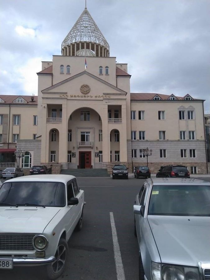
The dissolution of Soviet Union and the independence of the Republic of Armenia and the Republic of Azerbaijan found the region in a state of diverging nationalism, which, together with disputed borders, ended in a cruel and bloody war (for more information on how the conflict escalated, see Thomas de Waal: Black Garden: Armenia and Azerbaijan Through Peace and War. NYU Press, 2003, 360 p.). What is more important for us is the result of the conflict: surprisingly, the weaker but Russian-backed Armenians gained control over the region. In 1994, they ruled almost the entire Nagorno-Karabakh region, the strip to the east and south of it (which effectively connected Nagorno-Karabakh to Armenia), and the (ghost) town of Agdam to the east. Following the war, which claimed several tens of thousands of lives, the Azerbaijani population fled (or were routed) from the region, and it became a de facto (Armenian) state – the Republic of Artsakh – on a considerably bigger territory than the former Nagorno-Karabakh region. This quasi-state is not internationally recognized (not even by Armenia); only three similar, Russian-backed de facto states support its statehood. The Republic of Artsakh has approximately 150,000 inhabitants and has almost every institution of statehood (a parliament, high court, legal system, currency) while still being economically and militarily dependent on Armenia, symbolized perfectly by the local currency: it is merely used as a souvenir; the local people usually pay in Armenian dram.
The Extradition of the “Axe Killer”
Hungary became the closest to the conflict in 2012, during the extradition of Ramil Safarov, the Azerbaijani “axe killer”. Safarov was born in Djabrail – the city had been occupied since the 1990s by Armenians but was retaken during the recent conflict – and he claimed that he witnessed several of his relatives being murdered by Armenians. In 2004, he took part in an English language course in Budapest, where he – using an axe – decapitated his fellow Armenian student sleeping in the neighbouring room. He began his prison sentence in Hungary for the murder, but in 2012 Baku initiated his extradition, which was granted by Hungary (for him to serve the remaining years in an Azerbaijani prison). Notwithstanding, he was immediately released upon his homecoming and became a national hero. Armenia answered with the breaking of diplomatic relationships, and the relations between the countries have remained cold ever since (although as a Hungarian tourist, one could not sense this too much, and the name of the chess masters Péter Lékó and Judit Polgár is very well known in the chess-loving country). Oppositely, the official relations between Hungary and Azerbaijan are very good; the Hungarian government even supported Azerbaijan during the recent war, as well as now during the Azeri reconstruction efforts in the region.
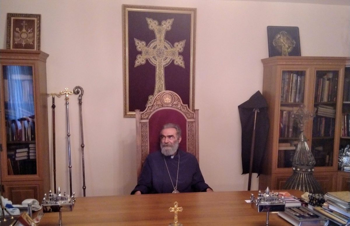
The Armenian Apostolic Church – one of the oldest in the Christian world – has an independent diocese in the Republic of Artsakh under the leadership of Archbishop Pargev Martirosyan. The archbishop played an active role during the war in the 1990s; he blessed the soldiers before they went to battle to take Shushi in 1992, and the day after the capture of the city, he led a prayer in one of the most important religious sanctuaries of the Armenians, the Ghazanchetsots Cathedral. That was the first Armenian prayer to be held in the church since 1920, which was used earlier as an Azerbaijani ammunition dump. More recently, during the autumn conflict, the church suffered considerable (partially deliberately inflicted) damage.
But why did the Armenians need to control such a bigger piece of territory than would have been ethnically justified? The explanation lies in the military geography of the region. Using a conventional twentieth-century military point of view, although Nagorno-Karabakh itself is a forested “mountain fortress” that rises above its surroundings with steep slopes averaging 1,100 metres above sea level, it acts as a necessary lifeline to Armenia. The borders of the former autonomous oblast are the closest to Armenia at the scenic city of Lachin. The distance is not greater than 10 kilometres as the crow flies, but there are some “minor problems” with this corridor.
First, the corridor is a row of serpentines on a very difficult terrain. Second, although the road leads directly to the heart of Nagorno-Karabakh (via the old capital Shushi to the new capital Stepanakert, the villages and towns along it had mostly been inhabited by Azerbaijani – there was heavy fighting for this road. On this very rugged terrain, the corridor cannot be easily defended. In order to use it, the defender must control a much broader strip – and this provides an explanation for the other issues concerning the defence of a much larger territory.
The area north of “the broader strip” is also a mountainous terrain, with a very high, almost inaccessible range at the juncture of the Armenian Highland and the Lesser Caucasus, forming a natural defence line to the north. If it is controlled by the Armenians, then they can easily defend the northern part of Nagorno-Karabakh (and certainly the corridor as well); if controlled by the Azerbaijani forces, then they can easily defend the area (or at least important parts of it). The strip south of the Lachin corridor to the river Aras has a more open terrain, and it offers a much more adequate battlefield for a conventional (and heavily equipped) army, which can threaten the central and southern areas of Nagorno-Karabakh – as was shown in the 2020 war. It explains why it was imperative for the Armenians to occupy and incorporate those areas into the Republic of Artsakh and why the loss of this region was such a tremendous tragedy for them.
Meanwhile, there was an earlier debate – according to the Madrid Principles – in Armenian politics and in international politics about those occupied territories that were not originally part of Nagorno-Karabakh. There were voices who said that those territories could be the key to an agreement that would officially recognize Armenian sovereignty over Nagorno-Karabakh. Before the “velvet revolution” of 2018, the Armenian political life had been dominated by the “Karabakh clan”; in general, this meant considerable political capital in Yerevan if somebody had Karabakh ancestry. Those political forces did not support any territorial concession. Contrary to this, the present prime minister – who is the first leader of the country who does not have Karabakh ancestry – had a milder position, and those opposing stances emerged during the recent conflict and during the unfolding protests as well.
Oppositely, Nakhchivan, the exclave of Azerbaijan, is a “reverse Nagorno-Karabakh” on the other side of the Zangezur Mountains (and Armenia), adjacent to the Turkish border. Earlier, the exclave had a mixed population, but now the proportion of Armenians is negligible, and their built heritage is mostly destroyed – the most renown example of the destruction is the cemetery of Julfa.
The war of 2020 raged exactly along the above-mentioned geographical conditions and obstacles. The original Azerbaijani attack in the north was stopped following a short retreat, but the second attack from the south gained ground rapidly, and it finally reached the central and southern regions of Nagorno-Karabakh; the Azerbaijani forces managed to occupy the emblematic and culturally important city of Shushi, cutting the highway to the Lachin corridor as well. It should be noted that the mass use of drones, and other twenty-first-century military methods, changed the warfare a lot, making the geographical advantage of the Armenian positions less significant. As a result, the Azerbaijani army could attack the remote mountain positions more effectively than was possible in the past. At first, the Azerbaijani army did not disclose casualty figures; both sides lost more than 2,000 soldiers (Armenia: 2,425; Azerbaijan 2,783 soldiers).
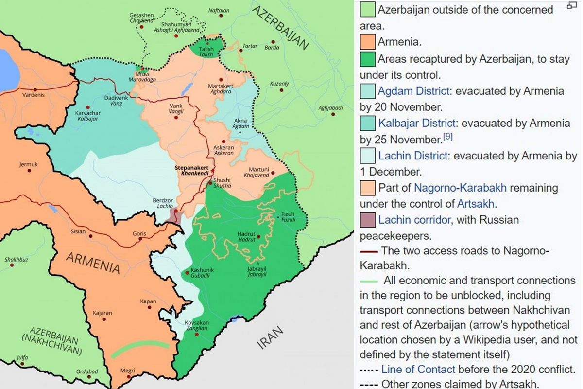
The armistice, signed quite unexpectedly on 10 November 2020, did not make the situation any clearer in the following days. According to the first news reports, the Azerbaijani could control the newly occupied areas, whether they were originally part of the Nagorno-Karabakh Autonomous Oblast (which is officially an integral part of Azerbaijan) or not. Other sources claimed that the Azerbaijani forces will gain control of the whole area between Armenia and Nagorno-Karabakh, as well as the newly occupied part of Karabakh north to Stepanakert. As an exaggeration of this version, there were claims in the media that only Stepanakert and its suburbs as well as the Lachin corridor will remain under Armenian control. The reason why such contradictionary reports could spread is that a different Azerbaijani and Armenian regional classification coexisted in the area, and it was not quite clear which areas the original Russian text of the agreement really covers.
The truth is that the agreement contains both territorial changes: the Azeri forces will control of all the recently occupied territories (which are de jure parts of Azerbaijan), as well as the southern areas of Nagorno-Karabakh and the city of Shushi along the corridor highway, and the Armenian forces should leave all territory still under their control, which was not part of the original Nagorno-Karabakh region. The north-western Kalbajar district should be evacuated by 15 November, the eastern Agdam district by 20 November, and the Lachin district by 1 December. However – contrary to the first news reports – the northern part of Nagorno-Karabakh will remain under Armenian control (with the exception of a small strip retaken by Azeri forces), together with the narrow Lachin corridor. A total of 2000 Russian peacekeepers will safeguard the region.
It has previously been reported that there will be an another “corridor” leading from Azerbaijan to the Nakhchivan exclave. However, according to the latest news reports, it seems to “translate” into a mere transit right – this means that Armenia has to allow the transit of Azeri passengers and goods on its own territory to Nakhchivan. (The Armenians can control the traffic, but, without an adequate reason, they cannot stop it – like East Germany in the case of the West Berlin transit after 1971.) This itself is a considerable improvement for the almost isolated exclave – up until now, “mainland Azerbaijan” could only keep contact with the exclave via Iran.
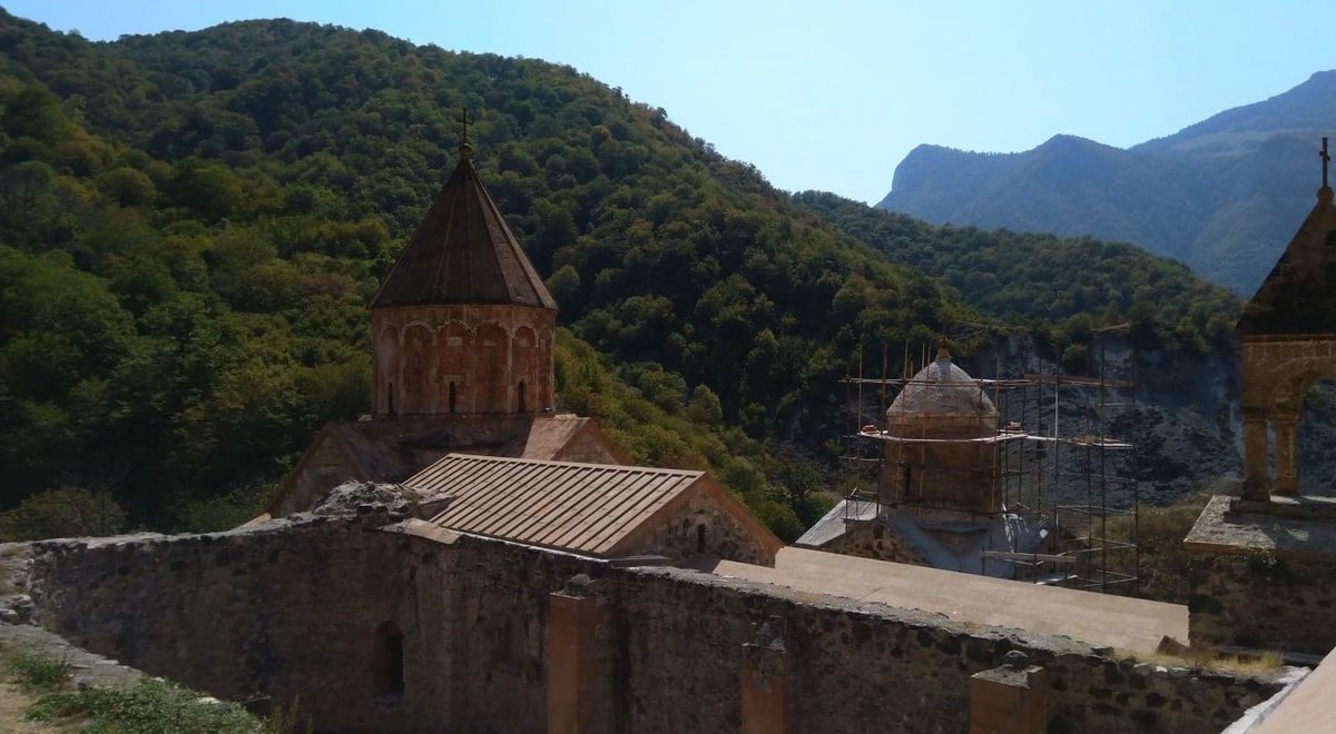
On the 15 November, the handover of the Kalbadjar district began, but not without dramatic events. The inhabitants of a little village, Charektar, set their houses aflame instead of giving them to the Azeri. One of the most important pieces of Armenian built heritage, the monastery of Dadivank (built between the ninth and thirteenth centuries), also lies in the Kalbadjar district. The local Armenians said farewell hand-in-hand to the building; according to the latest news reports, the Russian peacekeepers will secure the monastery and make visits possible for Armenians (like the Italian soldiers in the case of the monastery of Decani in Kosovo).
Simultaneously, the Russian forces also arrived and built 25 control points: 18 on the remaining territory of the Republic of Artsakh and 7 further in the Lachin corridor. Some sources mention that with this move the situation in the corridor has more or less stabilized. The exodus of the local Armenians has slowed down, although some of the Yerevan protests have been organized by the inhabitants of the corridor: according to the agreement the Russian peacekeapers are going to remain only for 5 years after this period the future is uncertain.
Until now, at least 50,000 Armenians have fled from the areas recaptured or regained by the Azerbaijani forces and from the Lachin corridor. At the same time, the Azeri and the Russians began to plan in earnest how to clear away the scars of war and to normalize the life in the affected areas. The Russians would participate in repairing and rebuilding the damaged or destroyed Armenian residential buildings, as well in the renovation and protection of the Armenian cultural heritage. They would secure the safe passage of 2 to 3 convoys daily from Lachin to Stepanakert via Azeri-occupied Shushi, until a bypass road is completed (if ever completed). Meanwhile, the Azeri have big plans regarding this most pivotal location: Shushi. They will make the city the “cultural capital” of Azerbaijan, in addition to festivals taking place following the reconstruction and a new hotel named “ Karabakh Victory ” being built in the city. Some sort of provocation could easily be discovered in these ambitions, which makes the success of the Azeri rebuilding and repopulation policy a bit questionable
Altogether, the peace agreement is a tremendous victory for Azerbaijan and a catastrophe for Armenia and especially for the Republic of Artsakh. According to the treaty, the territory of the quasi-state will shrink from 11,450 square kilometres to approximately 4,000 square kilometres, and it will be militarily vulnerable to and dependent on the Russian and Azerbaijani forces. At a workshop about the Nagorno-Karabakh situation, Bálint Kovács, the head of the Department of Armenology of Pázmány Péter Catholic University, thought that the quasi-state institutions of the Republic of Artsakh will remain in place; the question is how many of its Armenian inhabitants will flee in the future to Armenia. He claimed that Russia might be the real victor of the conflict: meanwhile, the country is directly involved in the other frozen conflicts (Abkhazia, Transnistria and South Ossetia) of the broader region, playing the role of a judge claimed by both parties. Moreover, Russia expanded its sphere of influence – through the stationing of soldiers – hundreds of kilometres to the southeast from its Armenian bases, without a single shot. According to some analysis, the Turkish support aimed to help the Russians gain ground, thereby weakening Western influence in the region.
The new situation and the rather sketchy nature of the agreement awakens many thoughts and questions:
- What will the fate be of the Armenian population on the areas regained by Azerbaijan? After the first days, it is more or less clear that they will leave most of those regions.
- Will Azerbaijan respect the territorial integrity of the remaining Republic of Artsakh? The victory gives a tremendous legitimation for the rather autocratic leader of the country; therefore, he most probably will not change the present situation, but it could change in the future if the Azerbaijani leadership needs further political legitimation.
- How will the defeat affect the rather democratic Armenia and Artsakh? Could they politically allow themselves to keep to the agreement, or will the pressure be too big in order to escalate the conflict? What else can they offer now for a more stable, internationally more recognized agreement than hopeless (but bloody) military resistance?
- How will the growing influence of Russia impact on the (rather democratic) political institutions of the two mentioned Armenian states?
- How will the fact that Azerbaijan gained a corridor to its main ally Turkey affect the geopolitical situation of the region? What will bring Turkey and Russia (and, according to some sources, Iran) politically closer?
- Who will finance and build the new Stepanakert-Lachin road bypassing Shushi? When will it be completed on the very difficult terrain? Following the completion, will the land connection to Stepanakert really work?
Central European (Carpathian Basin) Parallels and (dis)Similarities
In Hungarian political speach acts (on a rhetorical level), we can find parallels between the situation in the Lesser Caucasus and Székely Land and Transylvania in various sources. The ambassador of Azerbaijan to Hungary, Vilayat Guliyev (former Minister of Foreign Affairs in Azerbaijan, 1999-2004) said in 2017 that “[p]art of Azerbaijan has been simply ripped apart by Armenians. I am living in your country for a while, I know your history. What the Hungarians experienced with Transylvania, we experienced in the case of Karabakh”. Nagorno-Karabakh is often depicted in the Hungarian media as the “Armenian Székely Land”.
Although the loss of Transylvania and Székely Land runs in the Hungarian memory quite parallel, it is quite obvious that any parallel with the Karabakh situation leads to contradictionary understandings. The too simplified attitudes do not help us to understand what is happening in Karabakh, but – very cautiously – we can track the similarities: the words of the ambassador referring to the loss of Transylvania in 1918–1920 reflect the Hungarian point of view between the two world wars, which aimed at the total revision of the borders, whereas the Székely Land parallel represents the Armenian point of view on the ethnically based borders of Nagorno-Karabakh.
László Jakab - Dániel Zoltán Segyevy
